Contents
Overview
There are 9 virtual walks available on the National Disc (these are called 'surrogate walks' in the Domesday documentation). The available walks are as follows (note: these are the 'index' names for the walks rather than the on-screen title):
- A countryside walk
- A walk around a council flat
- A walk around a farm
- A walk around a showhouse
- A walk around a stone cottage
- A walk around a terrace house
- A walk around Brecon
- A walk around a detached house
- An urban walk
The titles and descriptions of the walks vary in the documentation, the title pictures, the indexed names and so on (and this can be a little confusing). The sections are therefore organised by the indexed name and information about other naming is provided in each section.
In the following sections you will find details about each walk including pictures and geographical information (if known) on the locations of the walks.
A countryside walk
Description from disc
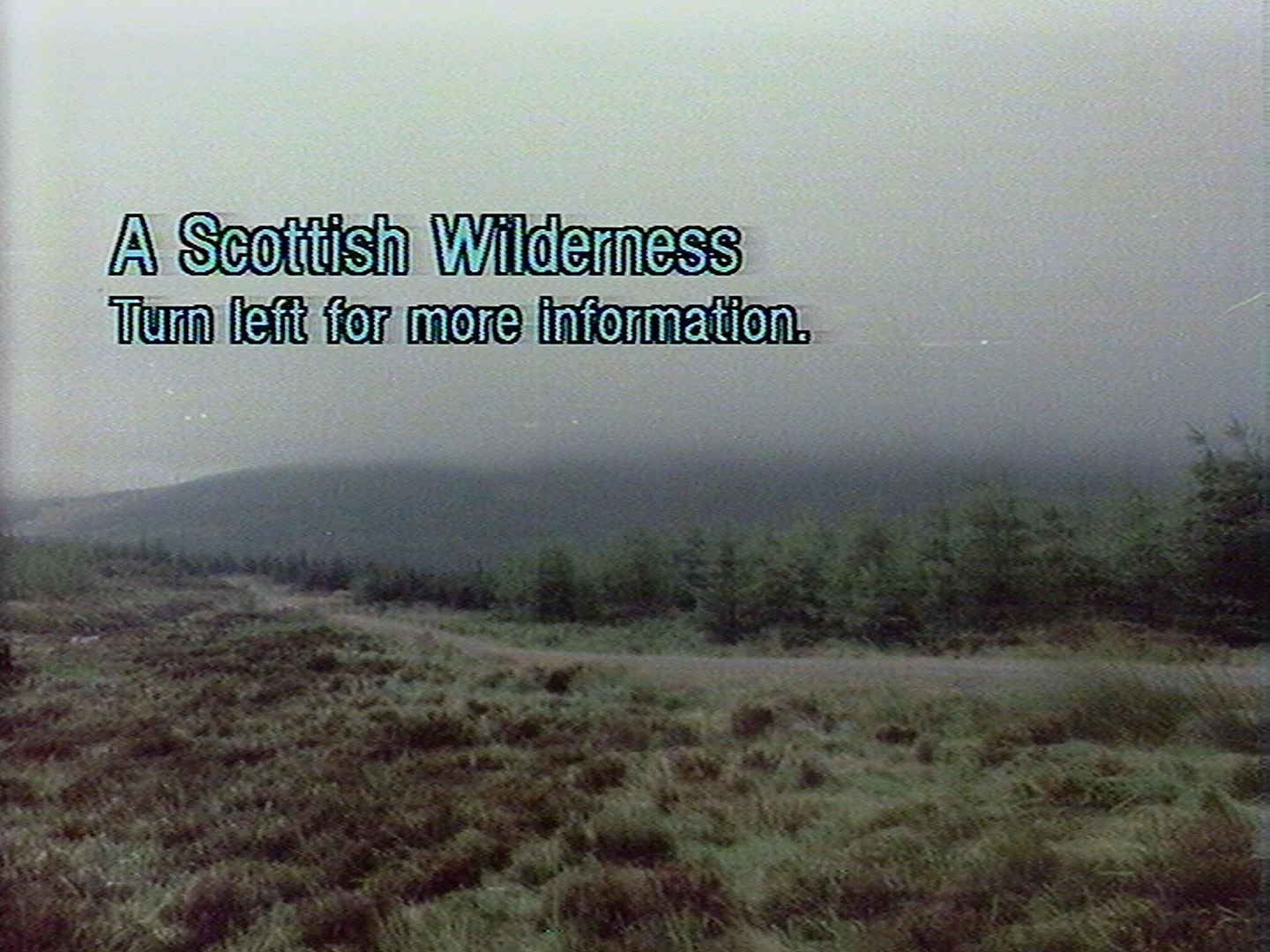
Title page
A Scottish Wilderness
Description
This is a forestry plantation and moorland in SW Scotland. Sitka and Norway spruce are planted in blocks of 3 to 30 years growth. The wettest sites are unplanted and are covered by purple moor grass and cotton grass. Heather grows on the drier soils. The soils are poor and acid with thick layers of peat in places. Rainfall is high.
Photographed: October 1985
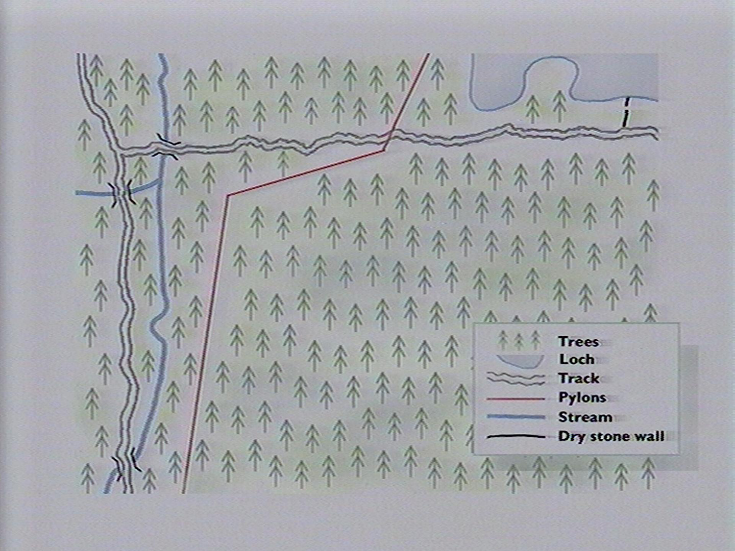
Plans
Frame information
Start frame: 37860
Total frames: 893
Geographical location
Unknown. Mentioned to be in the Dumfries area (during a talk at the CfCH).
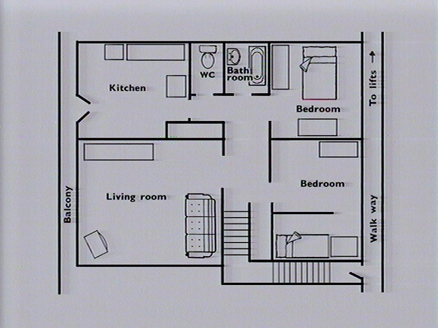
A walk around a council flat
Description from disc
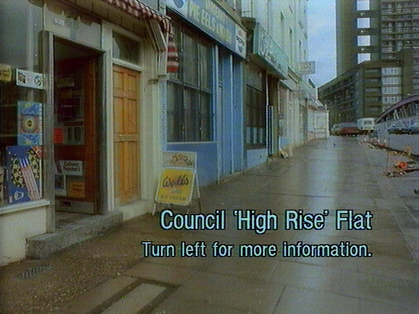
Title page
Council 'High Rise' Flat
Description
Council estates characterised by semi-skilled and unskilled families, high unemployment and some ethnic groups. Some households are large but there are many one parent families. Residents are generally younger than average and tend to move frequently. Few people have their own cars.
Typical locations: Hackney, Islington
Photographed: January 1986
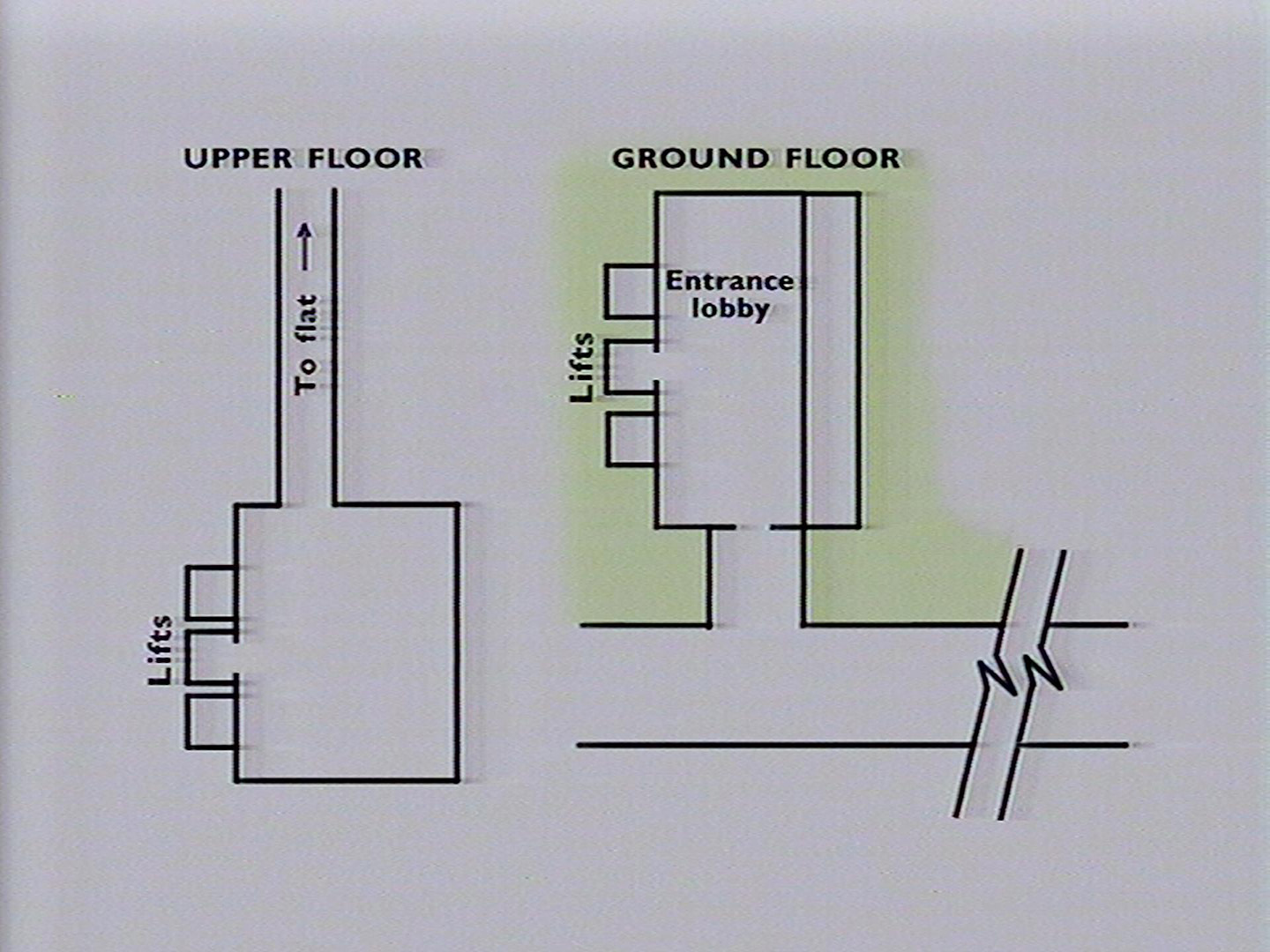
Plans
Frame information
Start frame: 30211
Total frames: 519
Geographical location
The high rise building featured in the walk is Trellick Tower. Trellick Tower is a 31-storey block of flats in Kensal Town, Royal Borough of Kensington and Chelsea, London, England.
The building can be found on Google maps using this link.
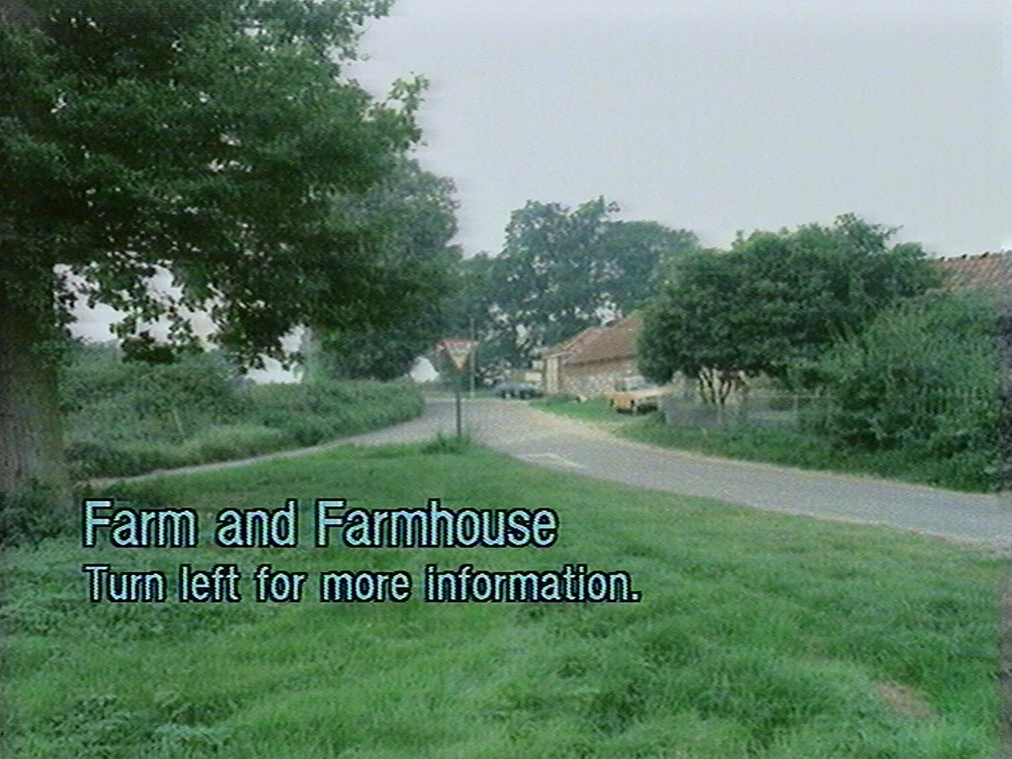
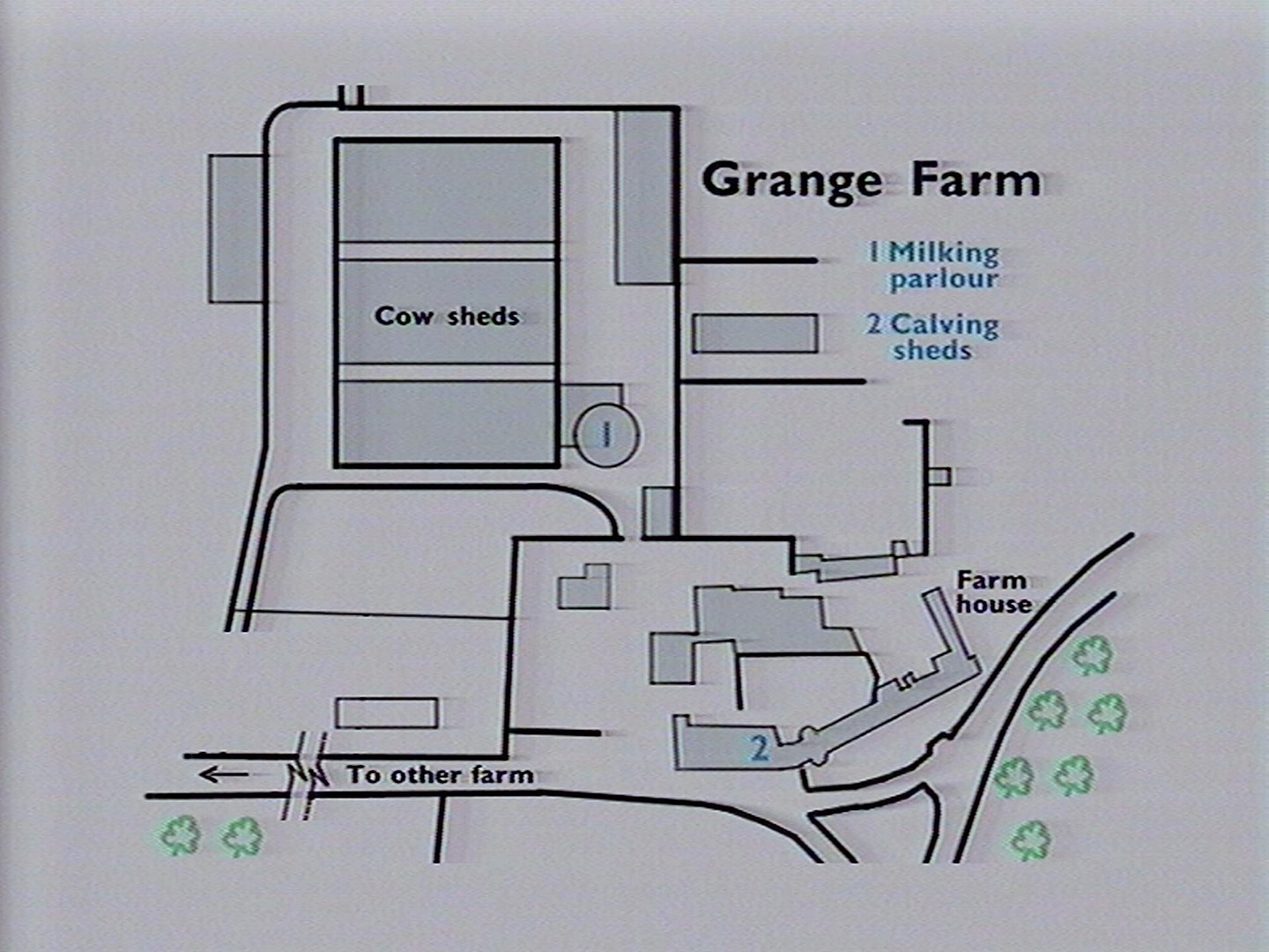
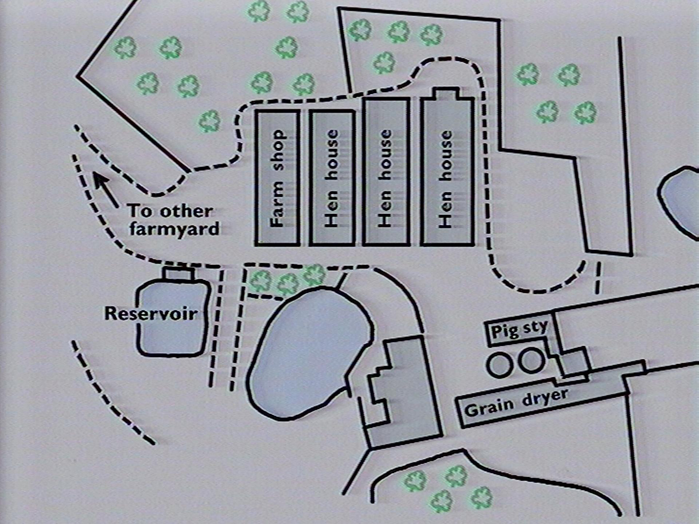
A walk around a farm
Description from disc
Title page
Farm and Farmhouse
Description
This is an 890 acre mixed farm in East Anglia. The main enterprise is a herd of 300 dairy cattle which graze outdoors most of the year. Crops grown include grass for silage, some maize for feed, 260 acres of cereals (which are dried and stored on the farm) and 200 acres of sugar beet. There are also pigs, battery hens and a farm shop.
Photographed: September 1985
Plans
Frame information
Start frame: 38760
Total frames: 2056
Geographical location
The farm is located at: Grange Farm, Buxton Road, Norwich NR10 3PR, United Kingdom
You can view the farm on Google maps using the following link.
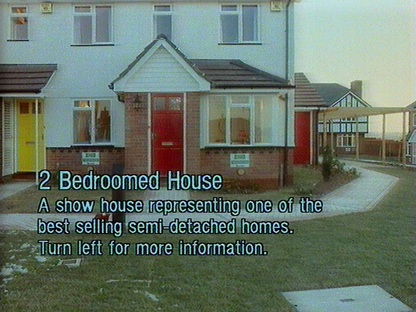
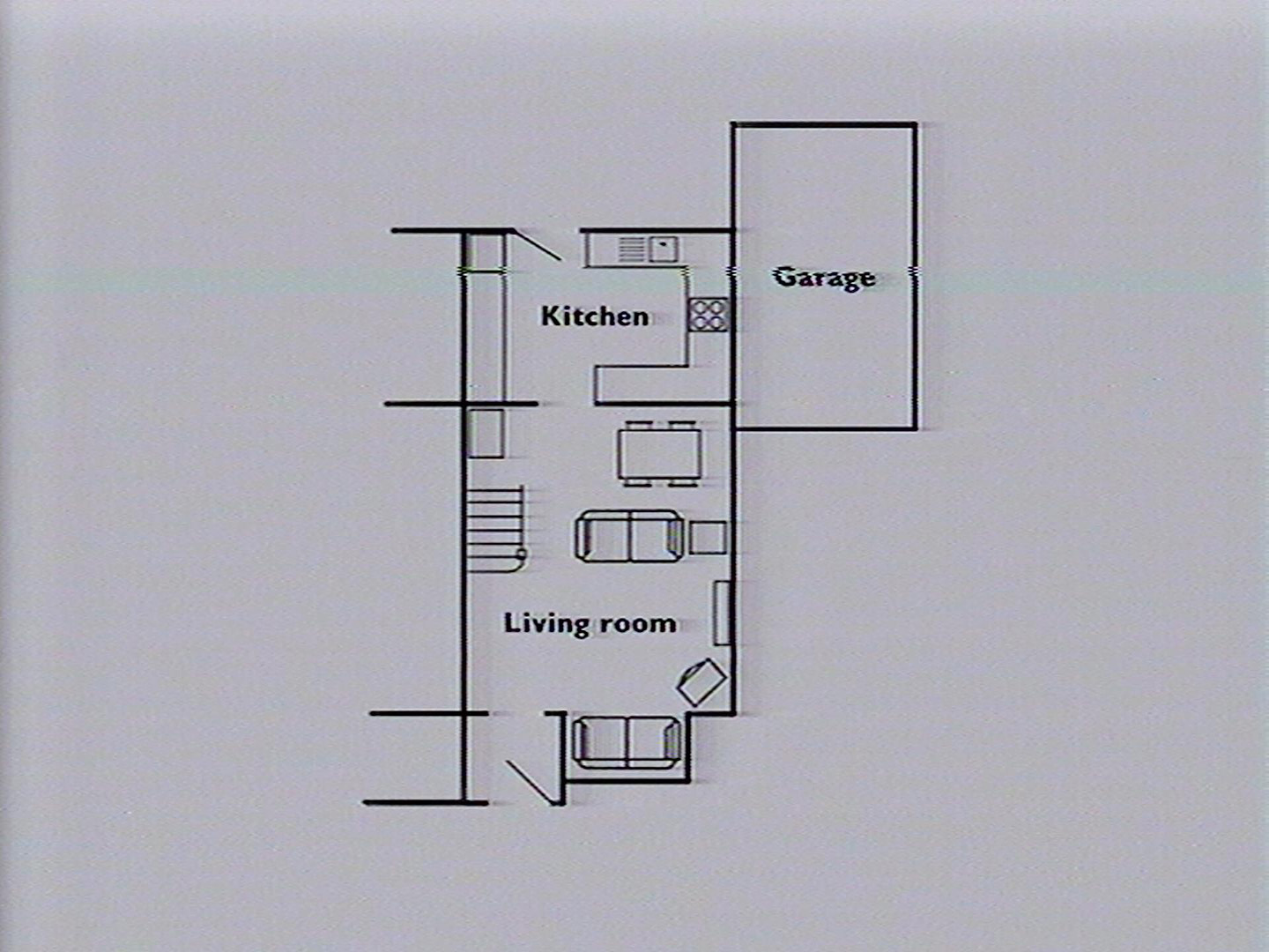
A walk around a showhouse
Description from disc
Title page
2 Bedroomed House
A show house representing one of the best selling semi-detached homes.
Description
Typical occupants: Mostly white collar with a minority of skilled manual worker. Young families with working wives, few old people. Most workers commute by car. High spending on consumer goods.
Typical locations: Tamworth, Basingstoke, Chelmsford
Photographed: February 1986
Plans
Frame information
Start frame: 29961
Total frames: 234
Geographical location
The show house featured on the disc is located at 8 Halfway Close, Birmingham, B44 8JL. You can view the house on Google maps using the following link.
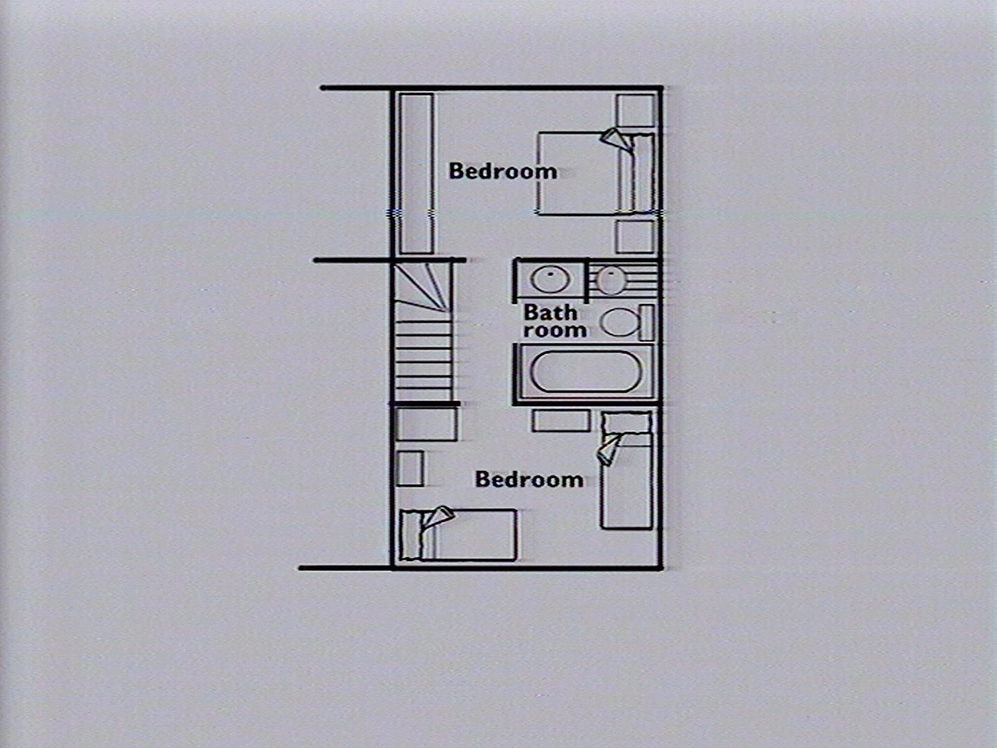
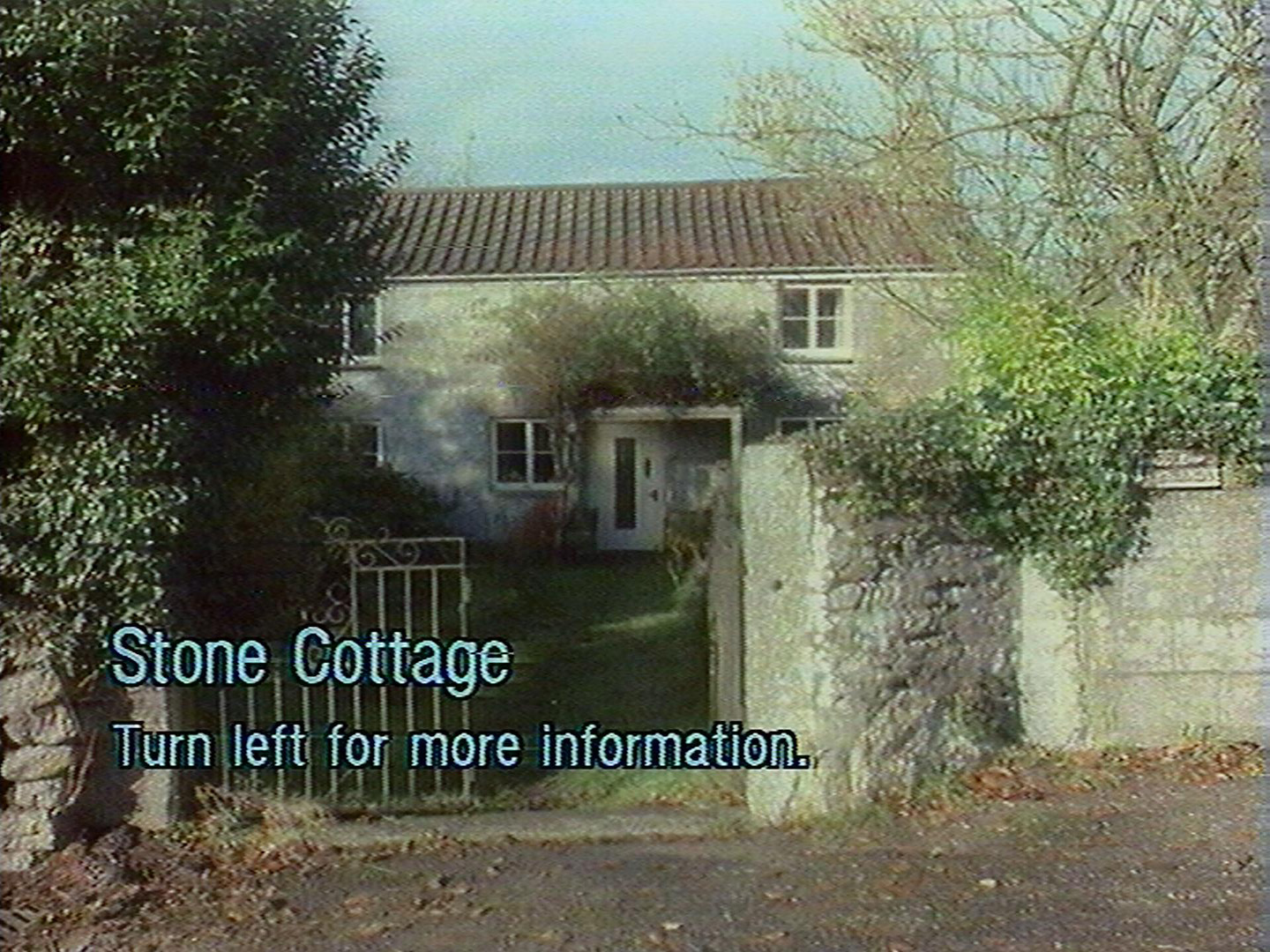
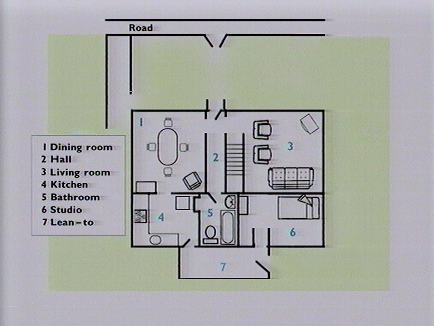
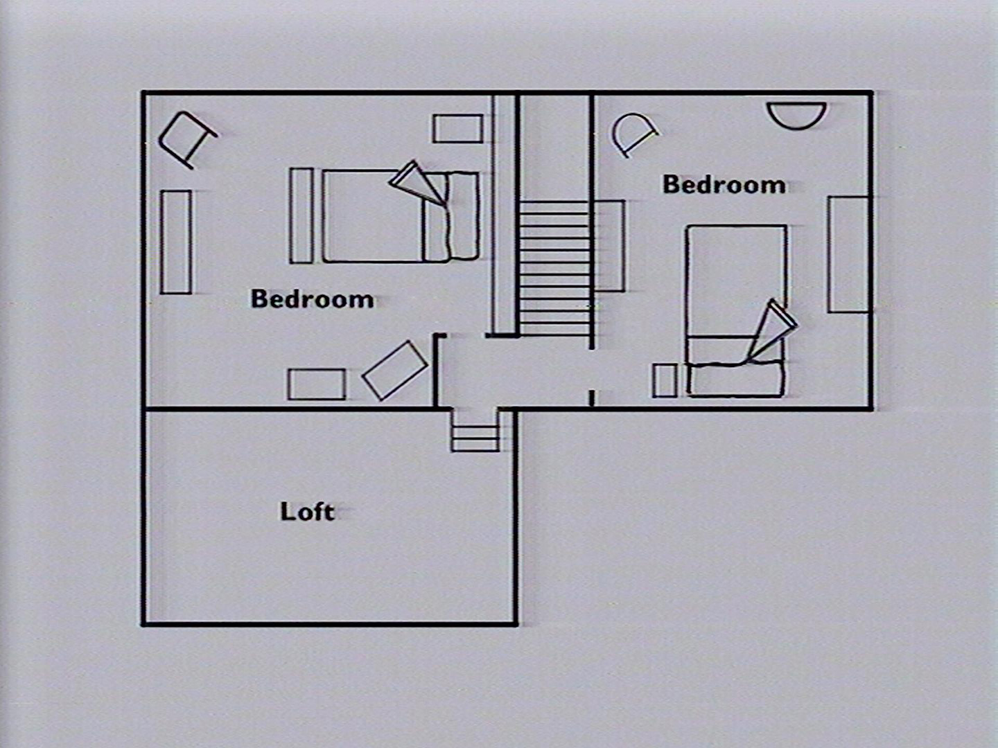
A walk around a stone cottage
Description from disc
Title page
Stone Cottage
Description
Found in rural areas where the communities depend mainly on farming for their livelihood. Also popular with retired and second-home owners. Few shops and services but high levels of car ownership. Population older than average with below average unemployment.
Typical locations: Cornwall, North Wales, Cotswolds.
Photographed: November 1985
Plans
Frame information
Start frame: 32236
Total frames: 777
Geographical location
Unknown. Likely to be near Bodmin, Cornwall (various reference to Bodmin and Fore Street in pictures). Mentioned as being in Cornwall during a CfCH talk.
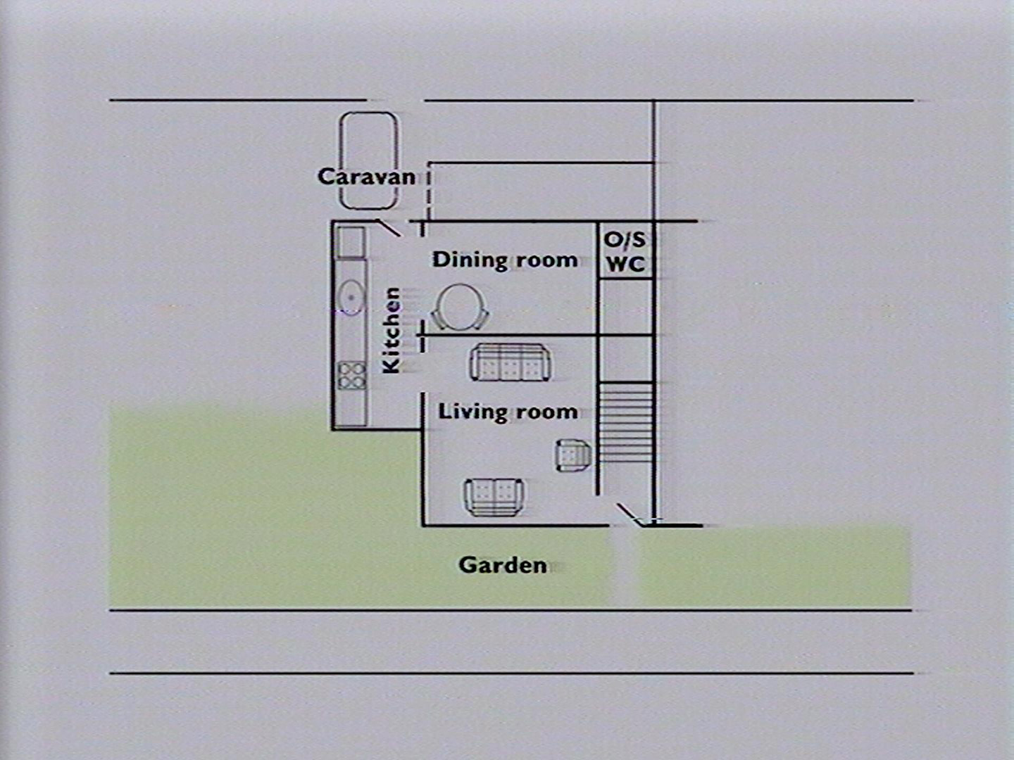
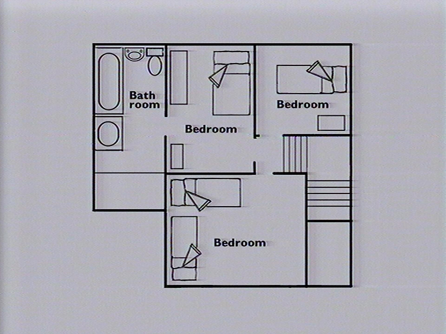
A walk around a terrace house
Description from disc
Title page
Terraced House
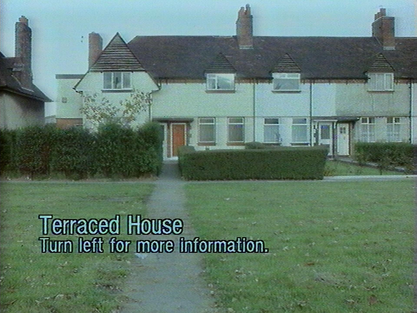
Description
Typical occupants: Mainly skilled and semi-skilled workers in manufacturing and mining. Age and family structure close to the national average but with more elderly people. Unemployment is typical of country as a whole. Property is a mixture of owner-occupied and unfurnished rental with low residential turnover.
Typical locations: Bolsover, Rugby, Merseyside
Photographed: November 1985
Plans
Frame information
Start frame: 31784
Total frames: 442
Geographical location
The house in the walk is located at: 193 New Chester Rd, Birkenhead, Wirral CH62 4RD, UK
You can view the house on Google Maps using this link.
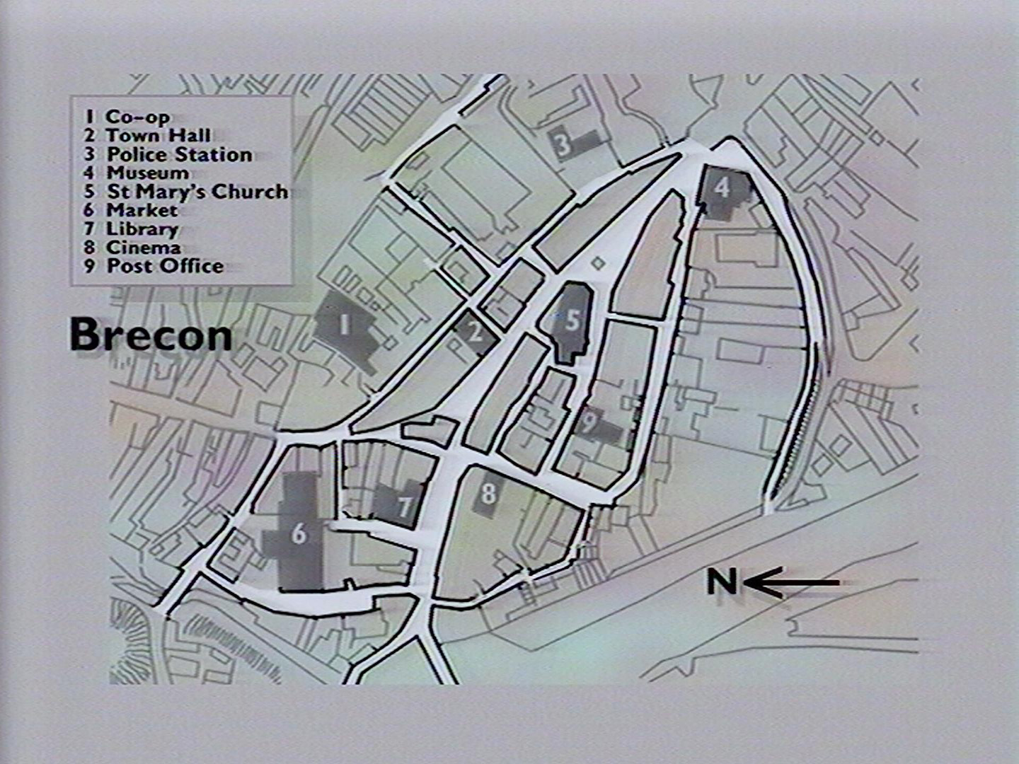
A walk around Brecon
Description from disc
Title page
Brecon
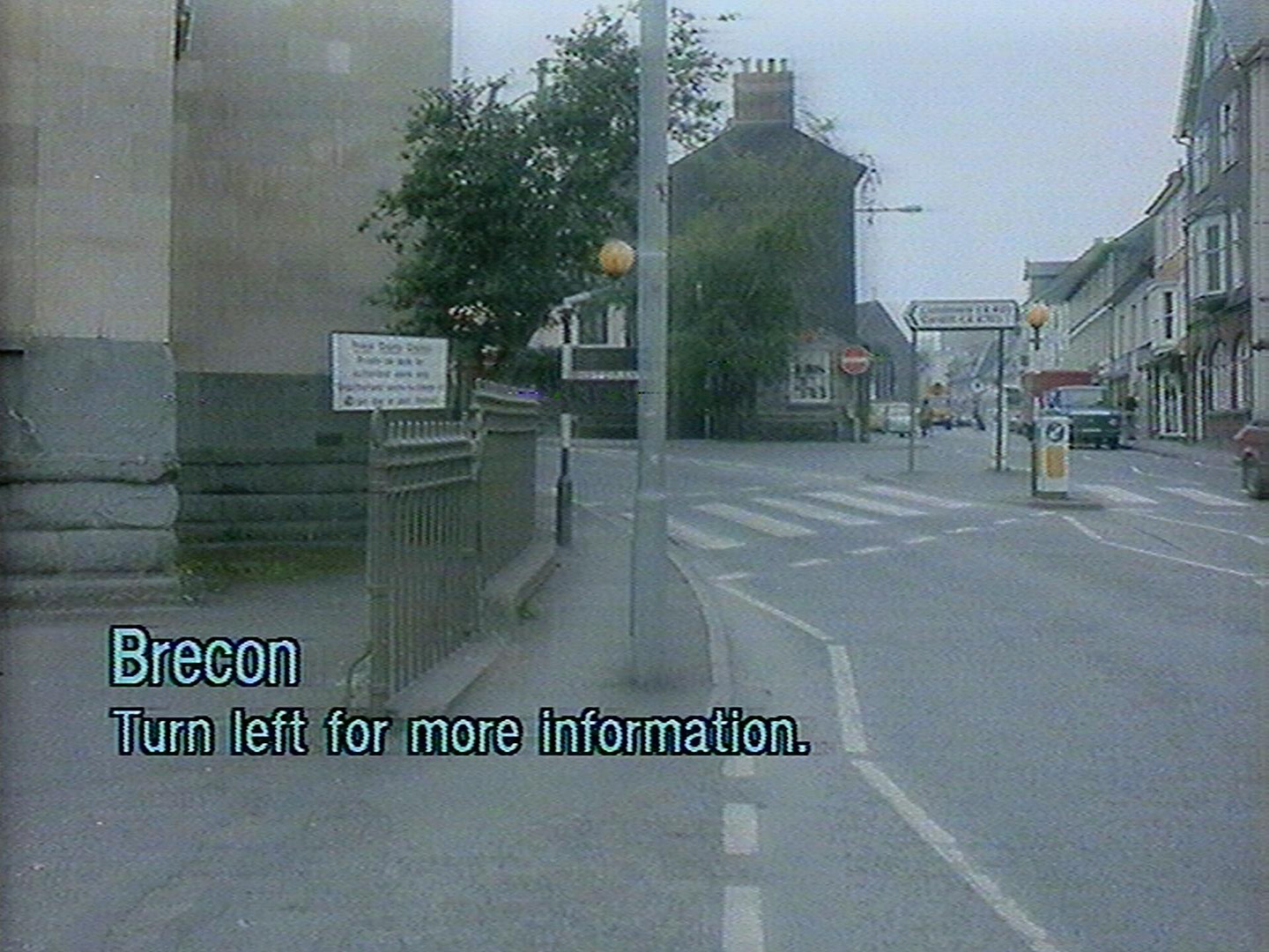
Description
Brecon in Powys (population 6,500) represents commercial and administrative life. It is the centre for the Brecon Beacons National Park and is also a market town with regular livestock auctions. As one of the oldest Welsh towns Brecon retains a charter to allow street fairs. Most people work in local shops and offices and there is a sense of a well integrated community.
Photographed: October 1985
Plans
Frame information
Start frame: 33035
Total frames: 2738
Geographical location
The featured area of Brecon can be found on Google maps using this link.
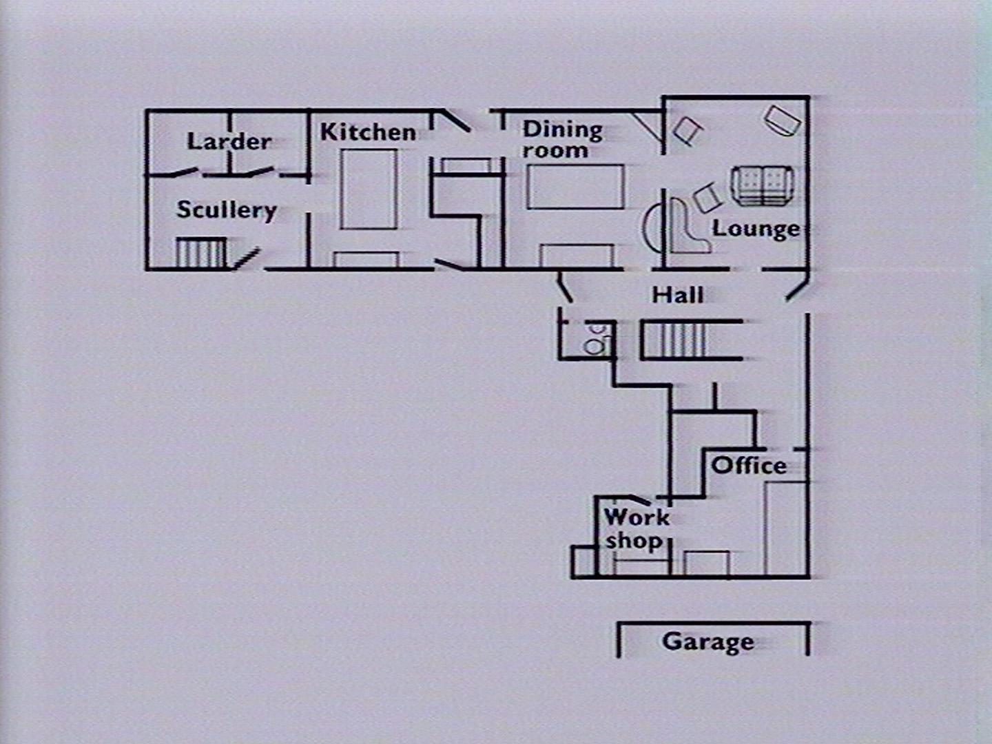
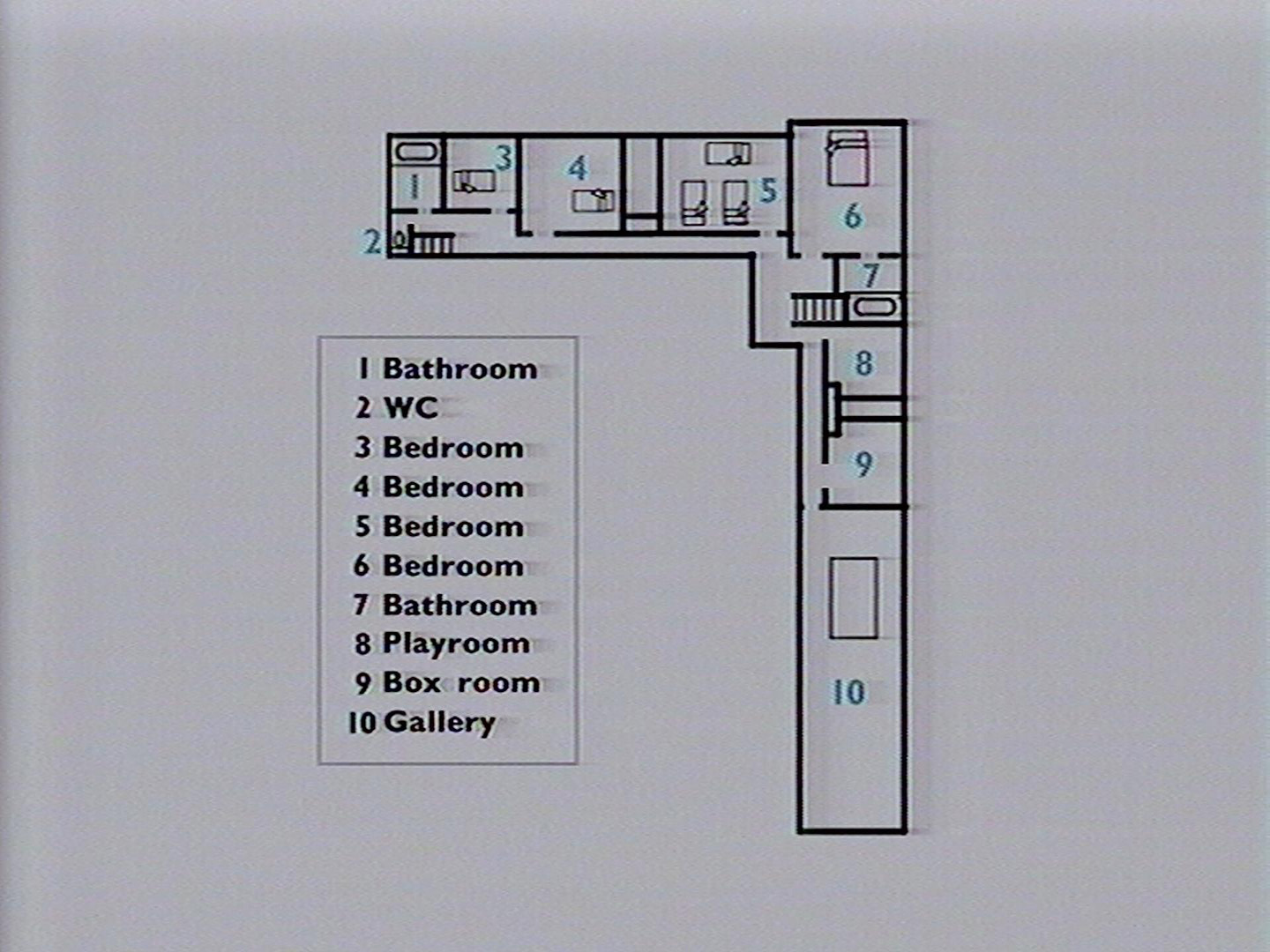
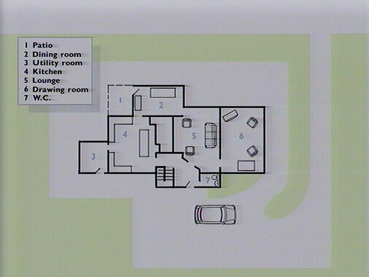
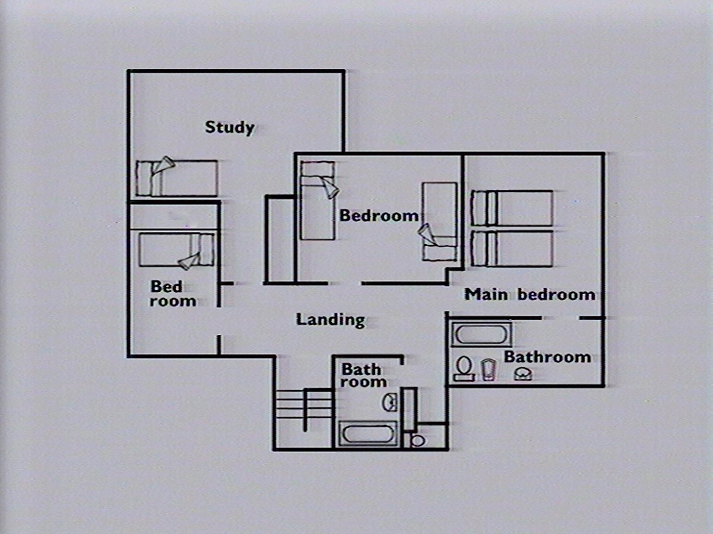
A walk around a detached house
Description from disc
Title page
'Stockbroker Belt' House
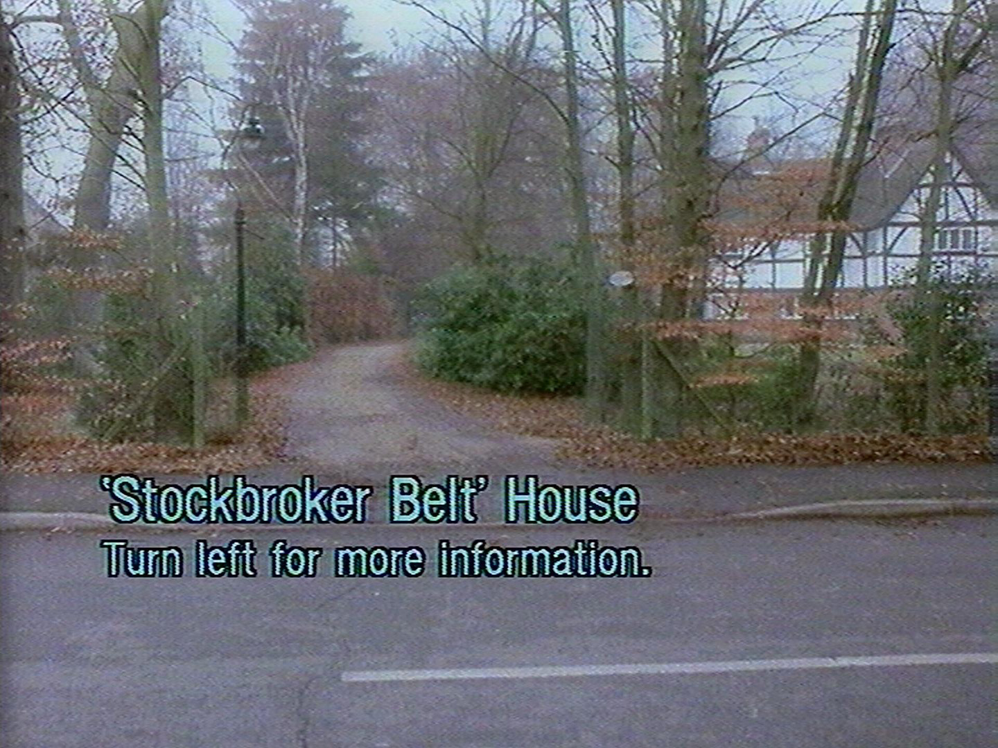
Description
Here is the highest concentration of professional and managerial workers, many commuting to office jobs. The unemployment rate is low. Families are usually small with children in secondary or higher education. Houses are mostly detached, in rural or semi-rural settings and owner-occupied. Residential turnover is low.
Typical locations: Epsom, Solihull, Bearsden, Ponteland
Photographed: December 1985
Plans
Frame information
Start frame: 30735
Total frames: 1033
Geographical location
Unknown. The house is most likely in the Wycombe district as there are various references to Wycombe in the picture set:
- #31329 - A map of Hurley
- #31335 - Wycombe Tele-Pages
- #31483 - Wycombe half-marathon medal
- #31486 - Barclays Bank slip "Beaconsfield Bucks"
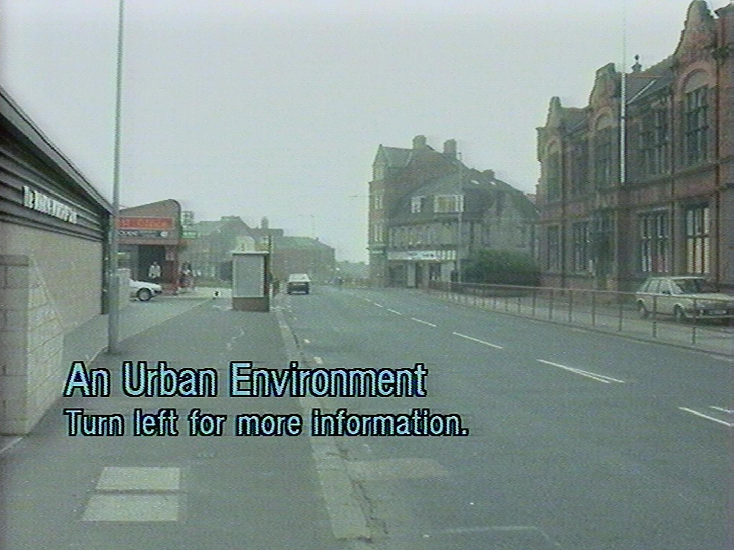
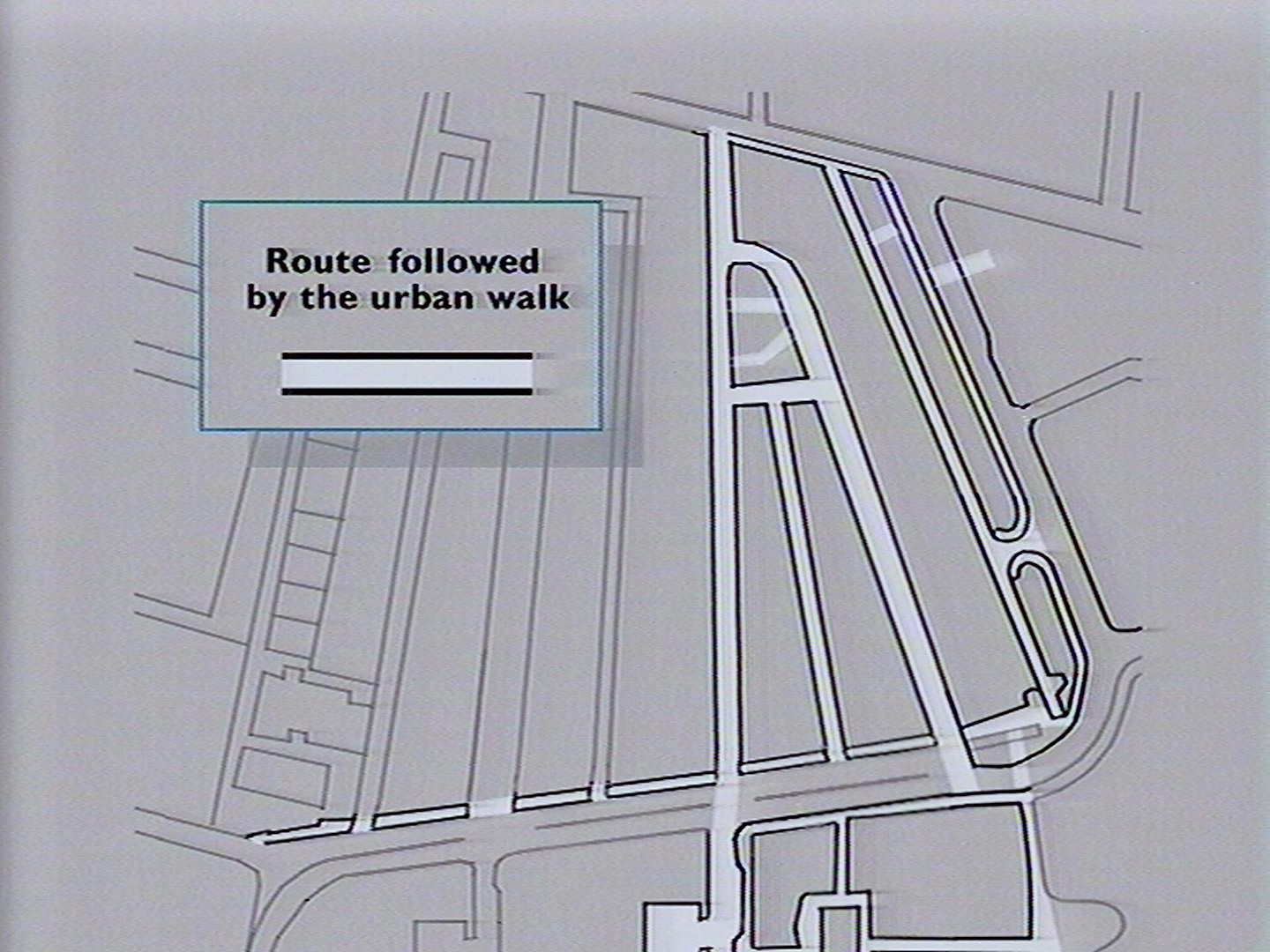
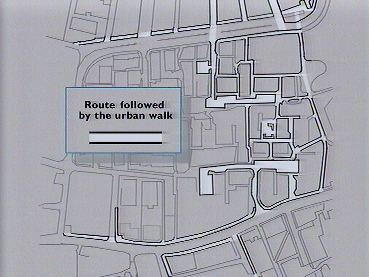
An urban walk
Description from disc
Title page
An Urban Environment
Description
An area of mixed housing with a multi-ethnic population in a Northern English city. Unemployment is high. Some houses have been improved - others are in need of repair. Major renovation of council owned terraces is underway. The low rise estate was built in the early 70s. Recent landscaping, provision of play areas and local workshops illustrates a change in the approach to urban planning.
Photographed: October 1985
Plans
Frame information
Start frame: 35786
Total frames: 2169
Geographical location
The location depicted in the walk is the Elswick Road area of Newcastle-upon-Tyne. The top-right of the map is Westgate Road and the bottom-left is Elswick Road. You can view the area in Google maps using the following link.